Nadico digitises buildings, plants and infrastructure with drones, photogrammetry, thermography and laser scanning, and turns the data into drawings, 3D models and BIM models that are useful for designing, inspecting and maintaining. We are a drone operator authorised by AESA/EASA with certified professional UAS pilots, which allows us to fly in industrial and urban environments safely and legally.
Industrial asset digitisation services
Drone surveys and photogrammetry
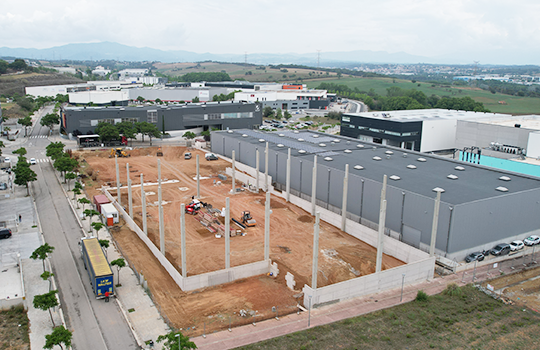
Photogrammetric flights that produce orthophotos, point clouds and 3D models with centimetre accuracy of plots, roofs, façades and complete buildings. It is the fastest and safest way to survey an existing building for a refurbishment, extension or renovation project.
Aerial technical inspections and thermography
High-definition visual inspection of roofs, rooflights, façades and structures without scaffolding or lifts, and aerial thermography of photovoltaic installations to locate faulty modules, hot spots and performance losses. Also envelope thermography to detect thermal bridges and damp.
BIM modelling and digital twin
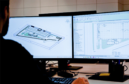
From laser scanning and photogrammetry we produce BIM models of the existing building (scan to BIM) and as-built models at the end of construction, the basis for facility management and future interventions. It links with our projects and with construction management.
Construction progress and corporate imagery
Periodic flight series to document construction progress, compare against the schedule and communicate the project: photo, video, 360 cameras and virtual reality content.
Services
- Photogrammetric flights and orthophotos
- Surveys of existing buildings
- Visual and HD inspections of roofs and façades
- Aerial thermography of PV plants and envelopes
- Laser scanning and BIM modelling (scan to BIM, as-built)
- Construction progress and 360/VR corporate content
- Drone assistance for hard-to-reach areas
Capabilities and certifications
- UAS operator registered with AESA (EASA regulations)
- Pilots certified A1/A3, A2, STS-ES-01 and STS-ES-02 plus radio operator
- Permit management and coordination with the competent bodies
- DJI Matrice 300 RTK with H20T (radiometric thermal) and P1; DJI Air 3
- Full-frame cameras, laser scanner, 360 cameras
Frequently asked questions about drone inspection and BIM
Can a drone fly over an industrial estate or in an urban area?
Yes, with a registered operator, pilots certified for the relevant scenario (STS-ES-01 or STS-ES-02 in urban environments) and the required coordination permits. Nadico handles all the paperwork before each flight.
How accurate is a photogrammetric survey?
With ground control points and RTK equipment, centimetre accuracy is achieved, sufficient for refurbishment projects, volume calculations and roof checks. For structural details it is complemented with laser scanning.
What is aerial thermography of a PV plant for?
In a single pass it detects faulty modules and strings, hot cells, damaged diodes and soiling, which reduce output without being visible to the naked eye. It is the basis of the plant’s predictive maintenance.
Let’s talk about your project
If you need a building survey, a roof inspection or thermography of your PV plant, let’s talk. Contact Nadico: 31 years of experience, more than 12,100 projects and six offices in Spain.